| Author | |
Erin
Forum Moderator

Joined: Feb 23 2005
Location: Australia
Online Status: Offline
Posts: 5814
|
| Posted: Nov 09 2011 at 11:46pm | IP Logged
|
 |
|
I've been reading about map drills and was wondering who employs this method for learning geography?
Charlotte Mason planned a 10 minute map drill once a week, giving the child a blank map of the region being studied, they were required to fill in as much detail as they could.
The secret apparently is to keep it short but frequent. Some proponents recommend daily drill.
We've tried a bit of mapwork/drills but our approach seems a bit hodge podge, I'd love to know what you do, how and what age?
__________________
Erin
Faith Filled Days
Seven Little Australians
|
| Back to Top |


|
| |
MaryM
Board Moderator


Joined: Feb 11 2005
Location: Colorado
Online Status: Offline
Posts: 13104
|
| Posted: Nov 10 2011 at 1:15am | IP Logged
|
 |
|
We've mostly relied on Shepherd Software maps for drill. Not very organized or regular here. Great topic though - will be watching thread.
__________________
Mary M. in Denver
Our Domestic Church
|
| Back to Top |


|
| |
jawgee
Forum All-Star

Joined: May 02 2011
Location: New Hampshire
Online Status: Offline
Posts: 1415
|
| Posted: Nov 10 2011 at 6:18am | IP Logged
|
 |
|
We have a hodge-podge approach to Geography right now, too. We are doing Geography: A Literature Approach using the HC Holling books. We are just finishing up with the first book, that covers the Northeast US.
In addition, and more for fun, we get Little Passports each month. My kids look forward to that. Each month we get a letter and a trinket from a different country. The kids like going on to the Little Passports website and learning more things about each country.
Finally, my oldest does map drills every week. Occasionally he likes to play this game (actually it's a little family challenge). Once a week, though, he does get a blank map of the US and attempts to write in all of the states. Eventually, when he masters that, we'll move to states and capitals.
Wow, that Shepherd Software looks great! I'll have to utilize that, too.
__________________
Monica
C (12/2001), N (11/2005), M (5/2008), J (8/2009) and three angels
The Catholic Cup on Facebook
|
| Back to Top |


|
| |
Mackfam
Board Moderator


Non Nobis
Joined: April 24 2006
Location: Alabama
Online Status: Offline
Posts: 14656
|
| Posted: Nov 10 2011 at 7:07am | IP Logged
|
 |
|
We do. It is effective because it's short and sweet. We've been doing this for several years. There are always living geography books in the curriculum, but this is how we approach the practical basics of knowing and understanding geography. This comes after elementary years spent with the Montessori maps so they already know some geography things.
Our method varies slightly, but works well for us.
METHOD we use:
Twice a week.
With atlas, study one specific map for 5 min.
Close atlas.
With blank map, label everything you can remember from the map. 5 - 10 min.
Done.
With each successive attempt improve on spelling and filling out the map a little more.
You can apply the same method to learning anything geography related:
states
countries
bodies of water
mountain ranges
landforms
TOOLS I use:
National Geographic Collegiate World Atlas - it helps to use a post-it note to mark the map the kids are supposed to be working on so they can flip right to it when they're studying the map. A note about the atlas: We have a *thing* for atlas'. We  them all! We have children atlas' and regular atlas' and atlas' of periods of history. But for this you need one, good, comprehensive academic (read: adult, not children's) atlas. I found I could stretch how far my $ went if I shopped for an atlas that was used (a year old), and also packed with features. them all! We have children atlas' and regular atlas' and atlas' of periods of history. But for this you need one, good, comprehensive academic (read: adult, not children's) atlas. I found I could stretch how far my $ went if I shopped for an atlas that was used (a year old), and also packed with features.
Uncle Josh's Outline Maps - I bought mine back when the internet was a baby (  ) and you still bought books and papers and hard copies. So, I make copies on my copier - but the pdf/cd/printable version would be really nice!!! I copy enough maps for each child to get through a term! This means on our little geography shelf they have everything they need without needing me - atlas, blank outline maps. ) and you still bought books and papers and hard copies. So, I make copies on my copier - but the pdf/cd/printable version would be really nice!!! I copy enough maps for each child to get through a term! This means on our little geography shelf they have everything they need without needing me - atlas, blank outline maps.
Geography Center
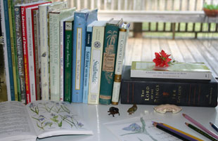
I keep a little geography center set up similar to the art center we've been talking about. I keep all our atlas', outline map sources, puzzle maps, compass and orienteering books and tools, living geography books, topo maps, etc. all together. And there is always a little place set aside for map skill work tools - so our collegiate atlas with a post-it and a folder of blank maps (enough for a term, or at least a few weeks if it's an easy map skill they're learning.) What I found with the geography center and access to a variety of atlas' was the same thing we found with the art center - ACCESS=INVITATION AND FAMILIARITY. In other words, the children go to the geography center on their own sometimes and pick up a beautiful atlas and just look through it...or grab a compass to take to the woods, etc.
Not sure if this is what you were looking for, Erin. But this is how we work on map skills. 
__________________
Jen Mackintosh
Wife to Rob, mom to dd 19 , ds 16 , ds 16 , ds 11 , ds 11 , dd 8 , dd 8 , and dd 3 , and dd 3
Wildflowers and Marbles
|
| Back to Top |


|
| |
Grace&Chaos
Forum All-Star


Joined: June 07 2010
Location: California
Online Status: Offline
Posts: 1261
|
| Posted: Nov 10 2011 at 8:33am | IP Logged
|
 |
|
I just started doing this too. I really enjoy it. I've only been doing it once a week. I'll use the same map outline, each time it is blank again: until the map can be filled within the few minutes time without effort. I decided to put the names/labels on the board. They stay up until we are finished with the particular map or geography area. It isn't a test, it's a tool for the girls to learn what they're studying. I've been pleased with the results. 
__________________
Blessings,
Jenny
Mom to dds(00,03) and dss(05,06,08,09)
Grace in Loving Chaos
|
| Back to Top |


|
| |
ShannonJ
Forum Pro


Joined: July 08 2011
Online Status: Offline
Posts: 172
|
| Posted: Nov 10 2011 at 8:35am | IP Logged
|
 |
|
Once or twice a week when we are doing our history or geography read-a-louds the kids sit down with their map work. They have one of those clipboards that opens to store the paper inside. I keep it stocked with one labelled map of the region, enough blank outline maps for the term, and several pieces of tracing paper. I also grab our bucket of colored pencils to have available in case anyone wants to add color to the maps.
We start by labeling the specific country that we are studying. Each week they are encouraged to study the map for a few minutes and fill in more countries. My daughter enjoys spreading out from the country that we started at. My son enjoys picking countries with names he is familiar with or strange names first. While I think I would have difficulty learning this way he can remember their placement quite well. He can't read yet so he enjoys simply telling me all that he can remember and coloring them in.
Just to say I don't require that my son do this, but he rather enjoys having his own clipboard and map work.
We usually end with a trip over to the wall map and they spend the next several minutes looking around at other things that peak their interest.
__________________
~Shannon
Mom of dd 12, ds 9, & dd 5
|
| Back to Top |


|
| |
SuzanneG
Forum Moderator


Joined: June 17 2006
Location: Idaho
Online Status: Offline
Posts: 5465
|
| Posted: Nov 10 2011 at 9:08am | IP Logged
|
 |
|
Oh....we LOVE our map drill time! we do it once a week and for about 10 minutes. We pick a continent for the entire year. I use this sitethese outline maps to print out.
We started last year, so I had a 4th, 3rd and 1st grader. This year, my 3 and 5 yo sit in and color the maps while we do it.
Everyone loves Map Drill! And, it's very effective!
__________________
Suzanne in ID
Wife to Pete
Mom of 7 (Girls - 14, 12, 11, 9, 7 and Boys - 4, 1)
|
| Back to Top |


|
| |
Erin
Forum Moderator

Joined: Feb 23 2005
Location: Australia
Online Status: Offline
Posts: 5814
|
| Posted: Nov 10 2011 at 2:22pm | IP Logged
|
 |
|
Love all these ideas, links and details, just what I wanted 
Jen,
That detail is preciously what I want.
Jenny
I like the idea of keeping the map up 
Shannon
Great idea studying it first, didn't even occur to me 
Suzanne
What a great idea, one continent for a year. Wondering which one to start with now, Australia or another.
Very heartening to hear it is effective.
__________________
Erin
Faith Filled Days
Seven Little Australians
|
| Back to Top |


|
| |
pmeilaen
Forum All-Star


Joined: Sept 07 2008
Location: New York
Online Status: Offline
Posts: 565
|
| Posted: Nov 10 2011 at 6:56pm | IP Logged
|
 |
|
In addition to looking things up in an atlas whenever we encounter a new place, we also study one continent per year, starting with our own (North America), then moving to South America, Europe, etc. I also use the series "Maps, Charts and Graphs". Karen Andreola has a short review here-- you can also look into the books there.
__________________
Eva
|
| Back to Top |


|
| |
keac
Forum Newbie


Joined: Oct 28 2011
Online Status: Offline
Posts: 42
|
| Posted: Dec 05 2011 at 9:32am | IP Logged
|
 |
|
We, too, follow a method akin to Mackfam's post above and as Sonya Shaffer of Simply Charlotte Mason describes in Erin's original post.
Another good resource that helped me visualize what Map Drills could be is this Parent's Review article by Gundry. He describes long sessions, which we break down over several weeks.
To help with Drills, I also do the following:
*Make a list of each's regions noteworthy physical features, key cities and any imports/exports, architectural or historical sites, etc that would add to our knowing of an area. This is not meant to be exhaustive! Just key or interesting features/landmarks. Then we might break it down and do all mountain ranges one week, then rivers, then cities, etc. Each week labeling first a map of the region from memory, then referencing an atlas and adding a few new labels to our map. Then file that map away and start afresh the next week.
*I read relevant chapters from Hillyer's OOP A Child's Geography of the World or from Ann Voskamp's work by the same title. Both help us visualize the area we are talking about, making a mental picture but still in broad terms---not to replace our in-depth geography readings.
*We've found Larry and Kathy Troxel's Geography Songs to be a great help, too.
*Sounds like alot but it really isn't. We choose one region to study per term (sometimes even spreading an area over two terms.) Once a week we'll read a small section from A Child's Geography of the World and narrate, looking at a map to "see" what is described. And we sing our Geography Song.
*Later that week, we'll bring out the blank maps and do the actual Map Drill. I find that the work we do earlier in the week really sets them up for success with the drill, having the names and places in their mind.
*There is very, very little mom prep time. At the beginning of the term, I'll make copies of all the blank maps we'll need, find a reference map that is clear and easy to read, and check the table of contents of Hillyer's book to see what chapters we'll read splitting the pages between the weeks. I make a copy of the Geography Song lyrics and map so each child can have that in front of them when we read. That's it for the whole term.
*We also will do a Geography Read Aloud in addition to this at another time of the week. Ideally it would be a book that correlates to our period of history study, if possible. It can even be historical fiction IF it is especially descriptive of the region's physical landscape, the customs of the people, or daily life (a couple G.A. Henty books come to mind).
-----------------------
Karen
|
| Back to Top |


|
| |
|
|


 Topic: Do You Use Map Drills?


 them all! We have children atlas' and regular atlas' and atlas' of periods of history. But for this you need one, good, comprehensive academic (read: adult, not children's) atlas. I found I could stretch how far my $ went if I shopped for an atlas that was used (a year old), and also packed with features.
 ) and you still bought books and papers and hard copies. So, I make copies on my copier - but the pdf/cd/printable version would be really nice!!! I copy enough maps for each child to get through a term! This means on our little geography shelf they have everything they need without needing me - atlas, blank outline maps.


